Want to climb up to the vulano? Or walk the meadows and see Santo Antao in it’s natural habitat? Here are some suggestions
The big one
You start from the Kasa and walk behind it up the vulcano passing by a little river, climbing up a steep footpath up the mountain ridge while passing papaya trees, sugar cane terasse-fields, woodlands, and magnificent vieuws of several valleys.
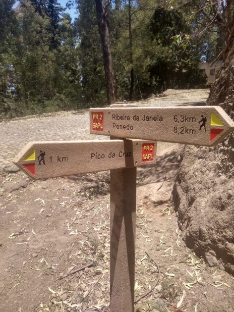
Once you reach the top (Pico da Cruz) there is a little village that was a shop to resupply and a place to sit under the trees in the shadow.
Due to the length, and the exposed nature of the path it’s best to start early in the morning, so you have a few hours of shadow.
You can download a GPS track and look in detail: here
Length: 20km. Total ascent: 1900m, Duration: 6 walking hours
The slightly smaller one
Very similar to the previous track, but slightly shorter and less steep.
You start from the Kasa and walk behind it up the vulcano passing by a little river, climbing up a steep footpath up the mountain ridge while passing papaya trees, sugar cane terasse-fields, woodlands, and magnificent vieuws of several valleys.
Once you reach the top (Pico da Cruz) there is a little village that was a shop to resupply and a place to sit under the trees in the shadow.
Due to the length, and the exposed nature of the path it’s best to start early in the morning, so you have a few hours of shadow.
You can download a GPS track and look in detail: here
Length: 17km. Total ascent: 1700m, Duration: 5-6 walking hours
Walk around the block
A small (less then 1km) reconnaissance walk around the village (Eito) with nice views on the valley and the local way of living and working.
As you leave the Kasa, head to the road, turn right and after a few 100m climb up a set of stairs (marked with white-yellow markings, see the second picture) and continue. Roughly halfway you will get the options to go left, down to the fields, of go up a little step to the right. Both options will merge later and get you back to the road. Enjoy the views and the sights underway.
You can download a GPS track and look in detail: here
Length: 800m. Total ascent: 80m, Duration: 15 minutes

